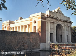
Battle Remains in the Ypres Salient, Belgium
This page lists some of the more well known battle remains which can be seen or which are accessible to visitors in the 1914-1918 Ypres Salient battlefields.
-
Bayernwald German Trenches
50.801393
2.876868
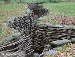
Wijtschate (2 kilometres north of the village)
Reconstructed section of original German trench system (access by prior booking from Heuvelland Culture & Tourism Service).
-
British Bunker at Essex Farm Advanced Dressing Station, Ieper-Ijser Canal
50.87173260614751
2.8729918599128723
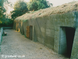
Western Ieper-Ijser canal bank, north of Ypres
Preserved bunker complex used by the British Army as a medical dressing station.
From the original dugouts in the earth of the western spoilbank of the Ieper-Ijser canal in April 1915, a medical treatment centre near Essex Farm was developed into a concrete bunker with several rooms by 1917. See our page giving information about the origins of the dressing station with a sketch showing the plan of the complex.
-
British Bunker at Zillebeke
50.83634827264336
2.9024840891361237
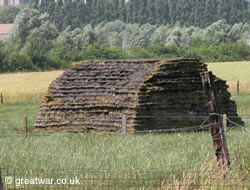
Komenseweg, off the N336 south of Ypres
(The bunker is on private land and not accessible, but can easily be seen from the road.)
This bunker can be seen in a field on the north side of the road near to Transport Farm British military cemetery. The horizontal lines in the concrete were created when sandbagging was laid onto the bunker's surface while the concrete was still wet.
-
Bunkers and Battlefield Relics at Pond Farm, near St. Julien
Fortuinhoek (6 kilometres north-east of Ypres)
50.88523310700978
2.9472917318344116
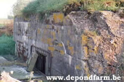
A private museum at the farm includes a collection of antique items from the First World War period and many fascinating relics found on the battlefields around the farm.
For a comprehensive history of the farm with photos and what visitors can see there go to the website:
Website: www.depondfarm.be
The farm near St. Julien was known as Pond Farm on British Army trench maps, and Kazerne Häseler on German military maps. After the Second Battle of Ypres in May 1915 the farm was in German occupied ground. By 1917 Pond Farm was one of many reinforced strongpoints in the German Army's defensive line. Three large bunkers, small bunkers, tunnels and cellars formed the fortifications at this place.
-
Cratered Ground and Bunker at Hill 60
50.82417590125372
2.929680347442627
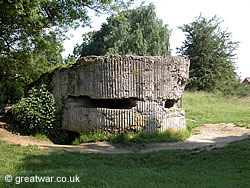
Zwaarteleenstraat, off Komenseweg at Zwaarte Leen
The cratered ground at Hill 60 was left relatively untouched after the First World War and preserved as a memorial
Many hundreds of French, British and German soldiers lost their lives in the fight for this area of high ground. A bunker can be found in the central area of the Hill 60 Memorial Site grounds.
-
German Command Post Bunker at Zandvoorde
50.80882758329445
2.9855145514011383
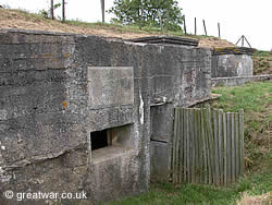
South of Zandvoorde village, south-east of Ypres
A preserved German command post built in 1916 in the rear area of the 1916 German Front Line.
See our page about the bunker and how to find it:
-
German Bunker near Langemark
50.924358926575515
2.913360446691513
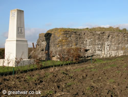
Beekstraat, off the Klerkenstraat north of Langemark
This bunker is similar to the three concrete bunkers within the German military cemetery at Langemark. It was captured by the British Army in September 1918.
It was used after that time as an Advanced Dressing Station (ADS) to treat the wounded. The memorial to the Royal Artillery and Royal Engineers of the British 34th Division has been located next to this bunker.
The bunker can be accessed by a path from the road at all times.
-
German Bunkers in Tyne Cot Cemetery
50.88703779655649
2.998020350933075
Tynecotstraat, south of Passschendaele village
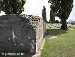
There are three German bunkers in Tyne Cot cemetery. One of the three bunkers is the location where it was decided to build the Cross of Sacrifice. The other two bunkers remain untouched.
For information about Tyne Cot Cemetery and the features in the cemetery including the bunkers see our page:
-
Hussar Farm Observation Post
50.858231918642325
2.915007323026657
N345 Kruiskalsijdestraat, south of Potijze village
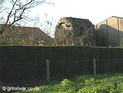
The Observation Post (O.P.) was built by the Royal Monmouthshire Royal Engineers inside the original farmhouse.
The brick and concrete structure was strengthened with railway lines and corrugated iron sheeting. In spite of the artillery shelling from the German guns for most the four years of war in the Ypres Salient this OP has survived.
-
Mine Crater on The Caterpillar at Zillebeke
50.8223649367603
2.9287952184677124
Zwaarteleenstraat, off Komenseweg at Zwaarte Leen
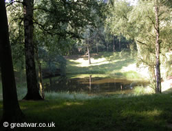
This crater was formed by a mine exploded under the German position on high ground south of the Ypres- Comines railway.
This high ground had been created by the spoil from when the railway cutting was made before the First World War. The high ground was known as The Caterpillar and it overlooked Hill 60, similarly created from the railway cutting spoil only a few hundred metres to its east. The mine crater has since filled with water and now forms a small round pond in the wood which has grown up since the fighting ended here.
Access to the crater is free. There is a path of about 100 metres to reach the mine crater from the road. Once in the wood the crater is located on the right of the path.
-
Mine Crater at Spanbroekmolen — The Pool of Peace
50.77589565988041
2.861487865447998
Kruisstraat, south east of Wijtschate
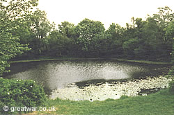
Mining underneath the enemy's position was a characteristic of warfare in the Ypres Salient. A number of large mines were exploded in the Ypres Salient.
Spanbroekmolen Mine Crater - Pool of Peace
The most notable of these were the 19 mines exploded in the early hours of 7 June 1917 at the launch of the British offensive on the German lines on the Messines Ridge. This mine crater is one of these mines. The crater created by the explosion here has filled with water due to the high water table and the clay soil.
The Spanbroekmolen crater was purchased by Toc H in the 1920s. It remained untouched until the 1990s, when it was formally named “The Pool of Peace” in Remembrance of the 1914-1918 war and those who fought in it.
-
Trenches at Sanctuary Wood (Hill 62)
50.8368380376
2.9459452629
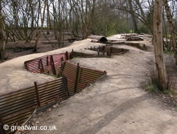
Canadalaan, off the N8 Menenstraat
When the farmer returned to reclaim his land after the fighting ended he left a section of trenches on his land in a wood near Hill 62, which had been known as Sanctuary Wood on British Army maps.
Preserved trenches at Sanctuary Wood Museum (Hill 62)
This is one of few sections of trench line with saps and a tunnel on the Western Front which can offer the visitor an idea of what they would have looked like.
-
Yorkshire Trench near Boezinge
50.88828562891589
2.8739064931869507
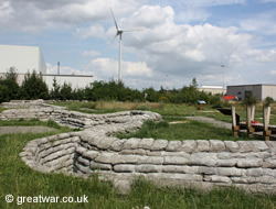
Bargiestraat, off the road called Oostkaie on the east side of the Ypres-Yser canal.
Yorkshire Trench was discovered and dug out during the development of the industrial zone to the north of Ieper in the late 1990s.
Related Topics
The numerous monuments and memorials on the Ypres Salient battlefields are listed with their locations, with links to pages detailing some of the most well known in the area.

